|
YEAR ON COVER |
DATE LOCATION |
DESCRIPTION |
SIZE |
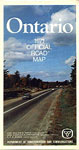
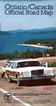
1971 |
On Cover Only |
The cover is a color photograph of a two lane highway which curves in the distances and has both evergreens and trees changing color in the autumn on each side of the road. All text is in white. |
4.75 X 8.5 |
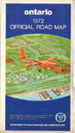
1972 A |
On Cover Only |
A colored drawing of an orange plane with “Norontario” markings flying over the intersection of two highways. The area above and below the drawing is dark blue with white text.
(Version A – Date on Map)
|
4.75 X 8.5 |
|
1972 B |
Code (72/1/2) |
A colored drawing of an orange plane with “Norontario” markings flying over the intersection of two highways. The area above and below the drawing is dark blue with white text.
(Version B – No Date on Map)
|
4.75 X 8.5 |
1973 |
Code (1173) in Sources of Information area. |
A colored photographic aerial view of Highway 71 at Berry Creek, near Sioux Narrows. The cover is predominantly green. All text is white. Three smaller color pictures are across the middle of the cover; a young lady near blossoms on a tree; a girl riding a horse in the autumn with colored trees in the background; a man skiing downhill. |
4.75 X 8.5 |
1974 A |
Not Dated |
A colored photographic aerial view of Highway 71 at Berry Creek, near Sioux Narrows. The cover is predominantly green. All text is white. Three smaller color pictures are across the middle of the cover; a young lady near blossoms on a tree; a girl riding a horse in the autumn with colored trees in the background; a man skiing downhill.
Map is not dated – 1173 is NOT in the Sources of Information area. Regional Municipalities – Halton, Peel, Haldimand-Norfolk and Durham are present on this map and not the 1973 version. |
4.75 X 8.5 |

1974 B |
In Legend (Aug. 31) |
A colored photograph of Highway 17 at Batchawana Bay with a single car – possible a Chevrolet Nova or Pontiac Acadian traveling along it. A lake is on the right side of the road and rocks, as would appear in the Canadian Shield are to the left. A clear sky with a bright sun is overhead.
|
4.75 X 8.5 |
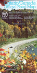
1976 |
In Legend |
A colored photograph of Highway 17 at Batchawana Bay with a single car – possible a Chevrolet Nova or Pontiac Acadian traveling along it. A lake is on the right side of the road and rocks, as would appear in the Canadian Shield are to the left. A clear sky with a bright sun is overhead. – “reprinted February 76” in legend
|
4.75 X 8.5 |
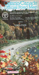
1977 |
In Legend (Jan. 1/77) |
A color photo of station wagon pulling a boat on a trailer uphill on Highway 17 near Goulais River. In the background is a large body of water surrounded by hills in the distance. A beach is visible along the edge of the water. |
5.25 X 10 |
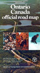
1978 – 79 A |
On Cover and Legend |
A color photograph from Algonquin Park of a curving road beside a body of water with a single vehicle. Trees are changing to autumn colors and clear blue sky is visible at the top of the cover. All text is in white except for the blue “Ontario/Canada Official Road Map” at the top. (Version A – English only version)
|
5.25 X 10 |
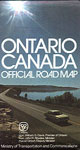
1978 – 79 B |
On Cover and Legend |
A color photograph from Algonquin Park of a curving road beside a body of water with a single vehicle. Trees are changing to autumn colors and clear blue sky is visible at the top of the cover. All text is in white except for the blue “Ontario/Canada Official Road Map” at the top. This version has French added to the “Kilometric Distances” & “Free Distribution” text on the cover and all English inside has been duplicated in French.
(Version B – Bilingual version – French added) |
5.25 X 10 |
|
1980 – 81 |
On Cover and Legend |
“Gore Bay – Manitoulin Island”. A color photograph which is mainly green in the middle, sky blue with clouds in the top 1/3 and rock gray in the lower 1/3 is used as a background. An “Ontario” flag that was used in a provincial tourism promotion campaign is used to help identify the map. Text below is white. A secondary road is visible leading downgrade to merge with a main road which is adjacent to the bay. A red and white vehicle is traveling along Highway 540. |
5.25 X 10 |
|
1981 |
Date Coded |
A color aerial photograph of the Noden Causeway taken when the lighting is subdued and the water is calm. Black text is used above the photograph and below the photograph is the “Yours to Discover” flag. The photograph is 4.5″ Wide X 5″ High.
(Date Coded – 81/R/1,500,000) |
5.25 X 10 |
|
1982 – 83 A |
On Cover, Legend and Date Coded |
White background with color aerial photograph of the Niagara Parkway in Niagara Falls, Ontario. Black text is used above the photograph and below the photograph is the “Yours to Discover” flag. The photograph is 4.5″ Wide X 4.75″ High. ( 1982 version Date Coded – (82/1,859,600) |
5.25 X 10 |
|
1982 – 83 B |
On Cover, Legend and Date Coded |
White background with color aerial photograph of the Niagara Parkway in Niagara Falls, Ontario. Black text is used above the photograph and below the photograph is the “Yours to Discover” flag. The photograph is 4.5″ Wide X 4.75″ High.
1983 version Date Coded – (83/1,526,000/R) |
5.25 X 10 |
|
1984 – 85 |
On Cover, Legend and Dated Coded |
A white cover with black text on the top and the Ontario “Yours to Discover Flag” and the Ontario Bicentennial Logo on the bottom for the Original 1984 version. A colored drawing, measuring 4 1/2″ wide and 5″ high is featured on the cover. It shows a night time city sky line with fireworks exploding over head. In the foreground are the streaks of headlights and taillights that occur with timed exposures in photography. Bicentennial Logo On Cover Ministers names on cover.
1984 version Date Coded – (84/1,911,200)
|
5.25 X 10 |
|
1984 – 85 A |
On Cover, Legend and Dated Coded
|
A white cover with black text on the top and the Ontario “Yours to Discover Flag” and the Ontario Bicentennial Logo on the bottom for the Original 1984 version. A colored drawing, measuring 4 1/2″ wide and 5″ high is featured on the cover. It shows a night time city sky line with fireworks exploding over head. In the foreground are the streaks of headlights and taillights that occur with timed exposures in photography.
No Bicentennial Logo On cover Ministers names NOT on cover.
1985 A version Date Coded – (85/1,424,000/R)
|
5.25 X 10 |
|
1984 – 85 B |
On Cover, Legend and Dated Coded
|
A white cover with black text on the top and the Ontario “Yours to Discover Flag” and the Ontario Bicentennial Logo on the bottom for the Original 1984 version. A colored drawing, measuring 4 1/2″ wide and 5″ high is featured on the cover. It shows the Gardiner Expressway with the Toronto skyline in the background with fireworks exploding overhead. In the foreground are the streaks of headlights and taillights that occur with timed exposures in photography.
No Bicentennial Logo On Cover Ministers names ADDED to cover
1985 B version Date Coded – (85/1,424,000/R) |
5.25 X 10 |
|
1986 – 87 A |
On Cover, Legend and Dated Coded
|
White cover with black text and a color photograph of the Ivy Lea Bridge located in the 1000 Islands of the St. Lawrence River near Ivy Lea, Ontario. The photograph is 4 1/4″ wide and 6″ high and portrays the main span of the bridge. Version “A” of the map has the “Ontario – Yours to Discover Flag” in the upper right corner of the cover.
1986 version Date Coded – (86/2,500,000) |
4.75 x 9.75 |
|
1986 – 87 B |
On Cover, Legend and Dated Coded
|
White cover with black text and a color photograph of the Ivy Lea Bridge located in the 1000 Islands of the St. Lawrence River near Ivy Lea, Ontario. The photograph is 4 1/4″ wide and 6″ high and portrays the main span of the bridge. Version “B” has a wider spaced font on the top and the ‘Discover Flag’ has been removed in favor of the new promotional logo across the bottom of the map – “Ontario – Incredible” (in English and “Ontario – Irresistible” (in French).
1987 version Date Coded – (87/1,900,000/R)
|
4.75 x 9.75 |
|
1988 – 89 A |
On Cover, Legend and Date Coded |
Version “A” has a white cover with black text and a color photograph of Highway 6 on Manitoulin Island measuring 3.75″ W and 5″ H. The photo portrays two vehicles approaching on the two lane rolling highway. Sunlight is breaking through in the center of the photograph to highlight autumn colors in the trees. A 1/4″ red bar is across 4/5’s of the top edge of the cover. The “Ontario Incredible” logo and minister’s names are at the bottom of the cover in English and French.
1988 version Date Coded – (88/2,000,000) |
4.75 x 9.75 |
| 1988 – 89 B |
On Cover, Legend and Date Coded
|
Version “B” has a white cover with black text and a color photograph of Highway 6 on Manitoulin Island measuring 3.75″ W and 5″ H. The photo portrays two vehicles approaching on the two lane rolling highway. Sunlight is breaking through in the center of the photograph to highlight autumn colors in the trees. A 1/4″ red bar is across 4/5’s of the top edge of the cover. The “Ontario Incredible” logo and minister’s names are at the bottom of the cover in English and French.
1989 version Date Coded – (89/1,650,000/R)
|
4.75 x 9.75 |
| 1990 – 91 A |
On Cover, Legend and Date Coded
|
1990 – Version “A” has a white cover with black text and a color photograph of Highway 6 on Manitoulin Island measuring 3.75″ W and 5″ H. The photo portrays two vehicles approaching on the two lane rolling highway. Sunlight is breaking through in the center of the photograph to highlight autumn colors in the trees. A 1/4″ red bar is across 4/5’s of the top edge of the cover. The “Ontario Incredible” logo and minister’s names are at the bottom of the cover in English and French. (This is the same cover used on the 1988/89 map.)
1990 version A Date Coded – (90/1,750,000/R)
|
4.75 x 9.75 |
|
1990 – 91 B |
On Cover, Legend and Date Coded
|
1990 – Version “B” features a photograph of Highway 17 near Wawa with a recreational vehicle traveling near a curve in the road. The photo occupies the upper 3/4’s of the map cover. “Ontario, Canada 1990/91” text is in pink, other text on photograph is white, black text is on bottom white portion of the map. Version “B” sports the “Incredible Ontario” Logo – the 1991 version doesn’t.
1990 version B Date Coded – (90/1,000,000)
|
4.75 x 9.75 |
|
1990 – 91 |
On Cover, Legend and Date Coded
|
The 1991 version features a photograph of Highway 17 near Wawa with a recreational vehicle traveling near a curve in the road. The photo occupies the upper 3/4’s of the map cover. “Ontario, Canada 1990/91” text is in pink, other text on photograph is white, black text is on bottom white portion of the map. Version “B” sports the “Incredible Ontario” Logo – the 1991 version doesn’t.
1991 version Date Coded – (91/1,315,000R) |
4.75 x 9.75 |
|
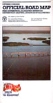
1992 – 93 |
On Cover, Legend and Date Coded
|
Photograph of Highway 60 at Lake of Two Rivers in Algonquin Provincial Park with trees showing autumn colors. The photographs measure 4.75″ X 6.25″. An oval Provincial Parks Centennial logo is on the face of the map. A band of white above and below the photograph with text. “Ontario” is across the top white band in black text. “Free Distribution” includedin lower text.
1992 version Date Coded – (92/1,790,000) |
4.75 x 9.75 |